

The Strand Homes for Sale, Manhattan Beach and Hermosa Beach
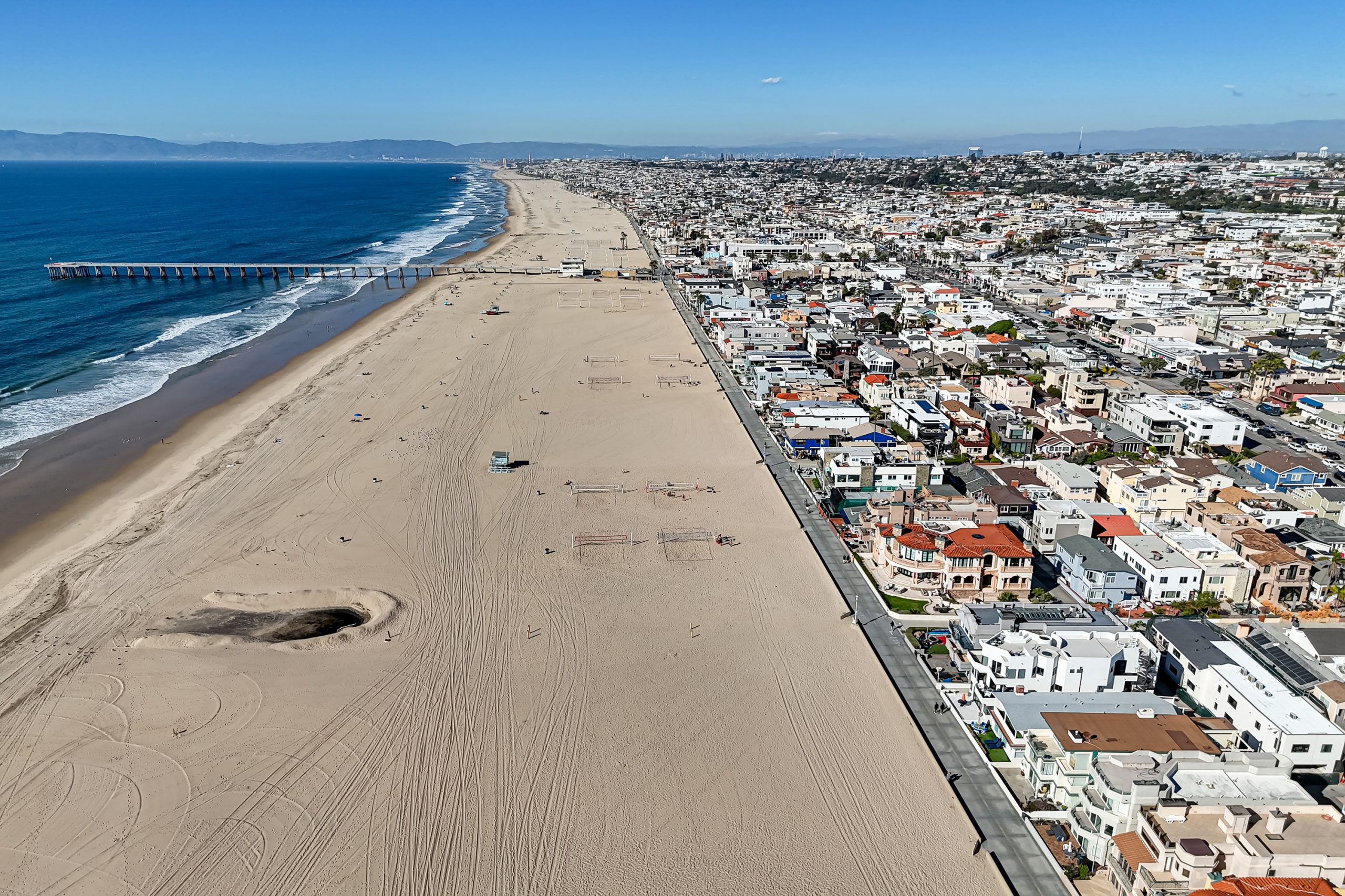
The Strand is the paved beachfront path running the length of the Manhattan Beach shoreline, carrying both a bike path and a walking lane. Homes front it directly, with no road between them and the sand.
It is worth being precise about what The Strand is, because it is often listed as though it were a neighborhood. It is a frontage, not a district. There is no Strand boundary, no Strand zoning designation and no separate MLS area. A Strand property sits within the Sand Section and is searched there.
What makes it a category worth understanding is that fronting The Strand changes the rules that apply to a property.
Why does The Strand have its own permit threshold?
This is the single most consequential fact about buying here, and it applies to almost nowhere else in the city.
Manhattan Beach has issued its own coastal development permits since its Local Coastal Program was certified on 12 May 1994. Within that framework, on The Strand and Ocean Drive a 10 percent addition triggers a coastal development permit that the identical work three blocks inland would not require.
A second rule compounds it: a coastal development permit is not effective until all appeals are exhausted, including any appeal to the California Coastal Commission.
So a modest expansion on a Strand property is a materially different project from the same expansion a short distance east, in both process and timeline. That is knowable in advance and worth building into any plan before an offer, not after.
What is it like to own on The Strand?
The defining feature is the path itself. A Strand-front home faces a continuously used public route, in both directions – the ocean on one side, a shared bike and pedestrian way immediately in front.
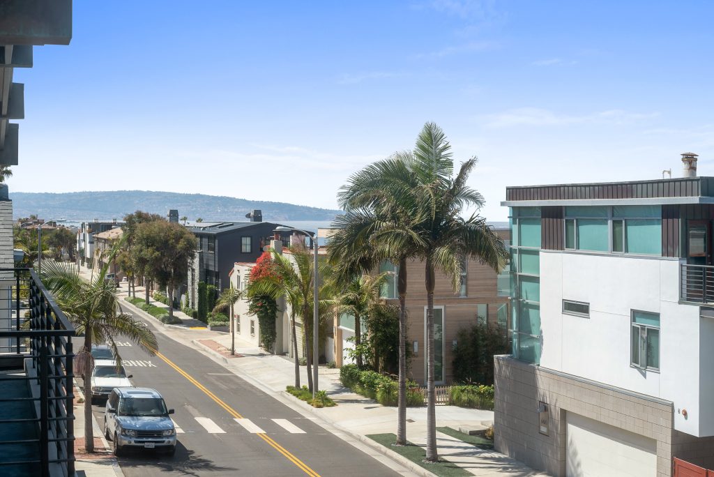
Access typically comes from the alley behind rather than from the front, the same pattern as the walk streets. Deliveries, parking and vehicle access all happen at the rear.
Anyone considering a Strand property should spend time there at different hours and on different days. Summer weekend conditions and a February weekday morning are not the same place, and the path is the reason.
What are the building standards?
Strand properties fall within Area District III, the Sand Section district. For single-family property that means a minimum lot of 2,700 square feet, a minimum width of 30 feet, a height limit of 30 feet and three stories, and a buildable floor area factor of 1.60.
That is the smallest minimum lot in the city paired with the taller of the two height limits. The coastal permit threshold above is the binding constraint on most Strand projects rather than the zoning envelope.
These standards cannot be loosened without a citywide vote. The City’s private-property tree protection ordinance does not apply, since the Sand Section is excluded from it.
Is the Manhattan Strand different from the Hermosa Strand?
Yes, and the differences are larger than the half mile between them suggests. The Strand runs continuously through both cities, but the two sides of the Manhattan and Hermosa line are governed by different cities, different building rules and different school districts.
Manhattan Beach sits north of the line. Its Strand blocks fall within the Sand Section, the city issues its own coastal development permits under a Local Coastal Program certified on 12 May 1994, and the whole city is one school district.
Hermosa Beach sits south. Its Strand blocks fall within the Hermosa Sand Section, CRMLS area 148, and the city runs its own planning department and its own permit path.
Lot configuration is where it shows up in price. The beach cities were laid out in narrow lots, and Strand parcels were assembled over the last century in different combinations. A triple lot beside a double lot creates a substantial difference in what can be built and how a property trades. Confirm configuration from the parcel record rather than from the frontage.
Does The Strand continue past the beach cities?
The path does. The addresses do not. This is the most common point of confusion about The Strand, and it is worth separating the two meanings.
As an address, The Strand exists in Manhattan Beach and Hermosa Beach. Those are the only two cities where you can buy a home with a Strand address. We checked this against CRMLS rather than assuming it.
As a path, it is much longer. What locals call The Strand is the Marvin Braude Bike Trail, roughly 22 miles of paved coastline from Will Rogers State Beach down to Torrance Beach. It runs the sand at Playa del Rey, turns inland briefly at Marina del Rey, and comes back to the water for the whole run through the beach cities. So Playa del Rey sits on the same continuous path, and has no Strand addresses at all.
Playa del Rey does have beachfront, it simply calls it something else. The homes that drop down to the sand there sit on Ocean Front Walk, which is the closest equivalent to a Strand address, and on Trolley Place just behind it. Vista Del Mar is the coastal road above them. Worth knowing before you go looking for a Playa del Rey Strand listing that does not exist.
One more naming trap while we are here. Playa del Rey has an Esplanade of its own, so that name is not unique to Redondo Beach either. If you are searching by street, scope it to the city or you will pull both.
South of Hermosa the corridor changes character rather than ending. In Redondo Beach the coast rises, and The Esplanade carries the same oceanfront role from the top of the bluff instead of from the sand. It is the blufftop continuation of the same stretch of coast, with a different relationship to the water: elevation and a view corridor in place of direct sand frontage. The path itself continues below and ends at Torrance Beach.
Chhabria Real Estate Company has represented more than 130 transactions along The Strand and The Esplanade, which is why we treat them as one coastline rather than two markets.
What size are Strand lots, and what is a double lot?
The standard Sand Section parcel in Manhattan Beach is 30 feet wide by 90 feet deep, 2,700 square feet. That single number explains most of what is unusual about building on The Strand. It is a narrow lot by any standard, and everything about the architecture here follows from it: tall, narrow, vertical, with the living space pushed up to the view.
The City’s Area District standards for the coastal districts set a minimum lot size of 2,700 square feet and a minimum lot width of 30 feet, with front and rear setbacks of five feet. They also set a maximum lot size of 7,000 square feet, and that ceiling is the single most consequential fact for anyone thinking about assembling land on The Strand.
| Configuration | Typical frontage | Approximate area | How often it trades |
|---|---|---|---|
| Standard lot | 30 feet | 2,700 sq ft | The default. Most Strand sales |
| Double lot | 60 feet | 5,400 sq ft | Uncommon. A meaningful step up in price per foot of frontage |
| Triple lot | 90 feet | 8,100 sq ft | Rare, and above the 7,000 square foot maximum, so it cannot simply be merged into one conforming parcel |
| Corner or street-end | 30 feet plus side exposure | 2,700 sq ft and up | Scarce. Light and air on two sides rather than one |
The practical consequence: on The Strand you are not buying square footage, you are buying frontage. Two adjacent 30 foot lots under one owner are worth considerably more than two separate 30 foot lots, because the combination buys something that cannot be manufactured. And because the City caps lot size, the assembly game has a hard ceiling. The lots that are already wide are effectively the entire supply.
Anyone considering a merger or a lot line adjustment should confirm current standards and the maximum lot size with Manhattan Beach Community Development before making an offer on that basis, at (310) 802-5520. These figures are the framework, not a determination for a specific parcel.
What does the City own in front of your house?
More than most owners expect, and this is the question that surprises people after closing rather than before.
On a walk street, and along much of The Strand, there is a strip between the private property line and the public way that functions as part of the house. Owners landscape it, furnish it, fence it and use it daily. Legally it is public right of way, and its use is governed by Chapter 7.36 of the Manhattan Beach Municipal Code, Private Use of the Public Right of Way, with encroachment standards at Section 7.36.150 and a City encroachment booklet that sets out what is permitted.
What this means in practice:
- The patio, planters, walls, hedges and hardscape you see in front of Strand and walk street homes frequently sit on City land under an encroachment allowance, not on the lot.
- What is allowed there is defined by the City and can be conditioned or required to be removed.
- Photographs of a property almost always include this area. The lot lines do not.
- Two houses side by side can have very different encroachment situations depending on what was permitted and when.
None of this is a reason to avoid a Strand or walk street property. It is a reason to read the survey rather than the listing photos, and to ask what is permitted before you plan a renovation around an outdoor space you may not own. We pull the encroachment position on any property we represent, and we will pull it on one we do not.
One further wrinkle worth knowing: the City has stated that several recently adopted ordinances, including the November and December 2025 revisions to Chapter 7.36, are not yet reflected on its own published Municipal Code pages. The current chapters are posted separately on the City’s zoning and development regulations page. If you or your architect are working from a downloaded PDF, check the date on it.
Which stretches of The Strand carry a premium, and why?
Price on The Strand is not uniform, and the drivers are physical rather than atmospheric.
- Frontage width. The single largest factor. Wider lots are scarce, capped by ordinance, and cannot be created.
- Proximity to the pier and downtown. Walkability to Manhattan Beach Boulevard is priced in. So is distance from it, in the other direction, by buyers who want the beach without the foot traffic.
- Walk street frontage. A property that fronts a walk street has no vehicle traffic in front of it and a pedestrian approach rather than a street approach.
- Street-end and corner positions. Light and air on more than one side, which on a 30 foot lot changes the whole design.
- Sand depth in front of the property. The beach is not the same width along its length. More sand between the house and the water changes the outlook and the noise.
- Elevation and grade. The Strand rises and falls. Where it rises, the view clears the bike path and the people on it.
The consistent theme is that the premium attaches to things that cannot be added later. You can rebuild a house. You cannot widen the lot, move the pier, or add sand.
What is the Marvin Braude bike trail?
The paved path running along the beach in front of The Strand is part of the Marvin Braude Bike Trail, a 22 mile route along the Los Angeles County coastline from Torrance Beach north to Will Rogers State Beach in Pacific Palisades. It was named in 2006 for Marvin Braude, the Los Angeles City Councilman who spent decades pushing for coastal access and open space.
Through Manhattan Beach the path is restricted to bicycles, and riders are required to walk their bikes for a short stretch near the pier. It is the reason a Strand property has constant movement in front of it from early morning onward, and it is also the reason The Strand functions as a genuine public promenade rather than a private beachfront road.
For owners, the trade is explicit: continuous public activity directly in front of the house, in exchange for the location. Buyers who understand that going in are happy. Buyers who expected a quiet private beach are not. We would rather you stand on the path on a Saturday in July before you write an offer than discover it in August.
How does the Coastal Commission affect a Strand property?
Every property on The Strand sits inside the California Coastal Zone, which means a second layer of land use control sits on top of the City’s. For most owners this is the difference between a renovation that takes months and one that takes considerably longer.
The short version. Manhattan Beach has a certified Local Coastal Program, certified by the California Coastal Commission on 12 May 1994. Because the City’s program is certified, the City issues coastal development permits itself rather than sending every applicant to the Commission. That is a significant advantage over jurisdictions without a certified program.
The catch is that certification does not remove the Commission. Two things survive it:
- Retained original jurisdiction. The Commission keeps direct permit authority over certain lands, including tidelands and public trust lands. On the beach side, that matters.
- Appeal jurisdiction. Certain City decisions can be appealed to the Commission, particularly development between the sea and the first public road. On The Strand, that description fits almost everything.
So a Strand project can be approved by Manhattan Beach and still be appealed to a state commission afterward. That possibility is not a hypothetical risk to price into a timeline, it is a structural feature of building on this block.
There is also a live issue worth knowing in 2026. The City adopted amendments to its Local Coastal Program on 1 April 2025 by Ordinance 25-0004, including a new chapter on accessory dwelling units, and further amendments on 2 December 2025 by Ordinance 25-0013. The City states plainly that these amendments are pending certification from the California Coastal Commission and are not yet effective. In other words, a rule the City has adopted may not yet govern your coastal zone property. Anyone planning an ADU inside the coastal zone should confirm the current status before spending money on drawings.
We have written a fuller explanation of how this works, what triggers a hearing and what it does to a timeline, on our California Coastal Commission page.
Which schools serve The Strand?
That depends on which city the address sits in, and the two systems do not work the same way.
Manhattan Beach is served by Manhattan Beach Unified, a K-12 district covering the whole city. Its elementary schools are Grand View (455 24th Street), Meadows (1200 Meadows Avenue), Pacific (1200 Pacific Avenue), Pennekamp (110 South Rowell) and Robinson (80 Morningside Drive). Mira Costa High School is at 1401 Artesia Boulevard.
Hermosa Beach is served by Hermosa Beach City School District, which runs kindergarten through eighth grade only. After eighth grade, students may attend either Mira Costa High School in Manhattan Beach or Redondo Union High School in Redondo Beach.
That split is not an accident. In November 1992 voters in Hermosa Beach, Manhattan Beach and Redondo Beach passed Proposition V by 59.1 percent, dissolving the old South Bay Union High School District and creating separate districts. The arrangement has been in place since 1993, and it is the reason two Strand addresses a few blocks apart can lead to entirely different school paths.
One thing worth knowing anywhere in the beach cities, because it is the opposite of what a listing implies: an address is a strong indicator of school assignment, not a guarantee. Districts finalize elementary placement through the enrollment process, and where a school of residence is impacted, a student may be placed at the nearest school with space. That is normal, it is manageable, and it is much easier to plan around when you hear it early rather than in August.
Attendance areas are set by the districts and they change. Verify with the district rather than a listing, a map pin, or this page.
Working with a Strand agent
Strand transactions turn on the coastal permit question more than anything else, and on understanding exactly what fronting a public path means day to day. If you are buying or selling here, we are glad to walk a specific address with you.
Continue exploring Manhattan Beach
This content is currently unavailable. Please check back later or contact the site's support team for more information.