
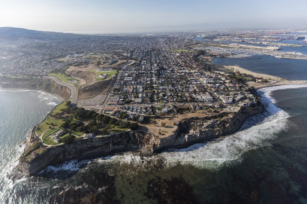
Most of the Palos Verdes Peninsula sits inside Palos Verdes Estates, Rancho Palos Verdes, Rolling Hills or Rolling Hills Estates. Not all of it does. Westfield and Academy Hills, La Rambla near San Pedro, and a small Open Space pocket are unincorporated Los Angeles County territory, with no city hall, no city council, and no city planning department.
Write an offer on one of them and about a dozen things change: who issues your building permit, how many horses you can keep, which ecological ordinance applies to a remodel, what shows up on your tax bill, and who you call when a streetlight goes out. None of it is hard once you know where to look, but you can’t tell any of it from the address on the listing.
Here is what applies, where each fact comes from, and the order to check things in.
Which parts of the Palos Verdes Peninsula are unincorporated?
Westfield/Academy Hills, La Rambla, and a small pocket the County labels Palos Verdes Peninsula. The County’s Countywide Statistical Areas layer returns each as a separate polygon.
| County name | Approximate location | Zoning returned |
|---|---|---|
| Westfield / Academy Hills | Adjacent to Rolling Hills Estates | R-A-1, R-A-20000, R-A-15000, plus R-3, C-H, O-S |
| Palos Verdes Peninsula (a small pocket the County labels with the same name as the whole Peninsula) | Small pocket | O-S (Open Space) |
| La Rambla | Near San Pedro | R-1, R-2, R-3, C-1, C-2, C-3, MXD, IT-DP |
Westfield is the pocket with a documented residential count. The Local Agency Formation Commission’s adopted Recreation and Park Districts Municipal Service Review, dated April 12, 2017, puts the district’s boundaries at 306 parcels, 304 homes, covering 198.4 acres, with a population of approximately 800 people, all within County unincorporated territory.
The small pocket labeled Palos Verdes Peninsula returns Open Space zoning, and its street-level extent has to be confirmed parcel by parcel. If a specific address turns on the question, GIS-NET Public or a call to Regional Planning at (213) 974-6411 settles it.
Three independent County sources name these areas separately, though not identically: the Sheriff’s Department Lomita Station service-area list, Supervisor Janice Hahn’s office, and the Fourth District Guide to Municipal Services in Unincorporated Areas, revised May 2026.
Can you tell from the address whether a Palos Verdes property is unincorporated?
No. A Palos Verdes mailing address does not show whether a property is unincorporated.
“Palos Verdes Peninsula” is the USPS place name for ZIP 90274. A mailing address in unincorporated Westfield reads “Palos Verdes Peninsula, CA 90274”, and so does a mailing address in an incorporated part of 90274. The address line gives the ZIP code’s postal name and nothing about jurisdiction.
The County also names the same ground differently from one department to the next. The statistical-areas layer says Westfield/Academy Hills. The Sheriff says Westfield and Academy Hill as two entries. Supervisor Hahn’s office lists Academy Hill, La Rambla and Westfield. The local special district calls itself Westfield Park Recreation and Parkways District #12. Search one name and you will not find the records filed under another, because the names have never been reconciled.
Marina del Rey has a similar issue: one ZIP code spans County and City of Los Angeles territory, and which side a property is on decides whether you are buying the land at all. See what you own in Marina del Rey.
The fix is a parcel lookup. Run the parcel number through one of these before the offer goes out:
- Z-NET, parcel-level zoning and overlay lookup
- Unincorporated Area Service Locator, address in, service providers out
If the parcel is unincorporated, everything below applies. If it is not, the property is in one of the Peninsula’s cities and that city’s code applies instead.
Who handles planning and building permits in unincorporated Palos Verdes?
Two separate County departments, where a city would use one counter.
Zoning and entitlements run through the Los Angeles County Department of Regional Planning, 320 W. Temple Street, Los Angeles 90012, (213) 974-6411. The building permit itself runs through County Public Works, Building and Safety, 900 S. Fremont Avenue, Alhambra 91803. Plan check is (626) 458-3173; grading and drainage is (626) 458-6333.
In Palos Verdes Estates or Rancho Palos Verdes, one city hall handles both. Here there are two departments with two intake processes, so plan for both before you submit anything.
The sequence that keeps this simple:
- Book a Connect with a Planner appointment with Regional Planning before anyone draws anything. It is the cheapest way to find out what the site will allow.
- Clear zoning and any entitlement with Regional Planning first.
- Submit the building permit through EPIC-LA, the County’s online portal. Submittal, fees, status, and inspection scheduling all run through it, so much of the process can be handled without a trip to Alhambra.
Two dates to keep on a calendar once a permit issues: request the first inspection within 12 months, and schedule follow-up inspections at least every 6 months to keep the permit active. Fee schedules are published on the Public Works site.
During the inspection period, also run the Building Permit Viewer will show permit history on the parcel. Unpermitted work is much cheaper to find before you own it.
What zoning applies, and can you rely on the online map?
The County General Plan 2035 applies directly. There is no community plan or area plan covering these pockets, Regional Planning’s community and area plan layer returns zero features over them, and the Metro Area Plan does not reach the Peninsula. Regional Planning assigns them to the South Bay planning area.
In Westfield/Academy Hills the residential zoning is Residential Agricultural, R-A-15000, R-A-20000, and R-A-1 (one acre), with pockets of R-3, C-H, and O-S. Verified General Plan designations across the same area are H2, H5, and H30 residential, CG general commercial, OS-C conservation, OS-PR parks and recreation, and P public/semi-public. La Rambla runs a conventional urban mix: R-1 through R-3, C-1 through C-3, MXD, and IT-DP.
Base standards for R-A come from County Code Title 22, Division 3, Table 22.18.040-A: 35-foot height limit, 20-foot front yard, 5-foot interior side, 15-foot rear, 5-foot corner side.
The public zoning layer carries inconsistent update metadata, the layer description reads as though it were last revised in 2014 while the underlying record shows a 2026 update. Treat any map as a starting point. Do not rely on a parcel’s zoning from a map when money rides on it. Use Z-NET for the working answer, and order a zoning verification letter from Regional Planning for anything that determines whether a project pencils. The letter is Regional Planning’s written answer for that parcel.
Pull one more overlay at the same time. Regional Planning’s Zoned District layer shows ZD 112 “Palos Verdes Peninsula” and ZD 101 “Rolling Hills” intersecting Westfield/Academy Hills. No Community Standards District, no Equestrian District, and no Setback District return over the area, but the two Zoned Districts do, and Z-NET will show which, if either, touches a given parcel.
What is the Significant Ecological Area, and does it apply to my parcel?
It can add cost to a project, and it applies only on the County side of the city line.
The Peninsula and its coastline are mapped as a County Significant Ecological Area. The County’s SEA Ordinance applies only in unincorporated territory. Inside the Peninsula’s cities, the same ecological mapping carries no County ordinance, the layer flags those polygons “SEA Ordinance does NOT Apply, Incorporated City.”
The practical consequence: a Westfield parcel inside an SEA polygon can trigger biological study and added review that an identical project one parcel across the city line would not. Same hillside, same habitat, different process.
What to do about it: run the parcel through Z-NET and check the SEA layer before removing contingencies on a teardown or a major addition. If it hits, book the Connect with a Planner appointment and price a biological assessment into your feasibility numbers from the start. If it does not hit, you are looking at a conventional Title 22 project and the SEA question is closed. Either way you have the answer in week one, with time to adjust your numbers.
Can you keep horses in unincorporated Palos Verdes?
Yes, under the general County limits. No Equestrian District covers these areas, so the standard Title 22 rules apply without a local exception.
Title 22 Chapter 22.70 lets the County establish Equestrian Districts, which supersede the general Title 22 rules on keeping horses and other large animals. Table 22.70.040-A lists every established Equestrian District in Los Angeles County, Rancho Potrero De Felipe Lugo, West Altadena, Pellissier Village, Kinneloa Mesa, Beverly Acres, and Avocado Heights. None is on the Palos Verdes Peninsula, and Regional Planning’s Equestrian District layer returns zero features over Westfield/Academy Hills. No district has been formed here, so the general Title 22 rules apply.
The numbers, from §22.140.070:
- 15,000 square feet per dwelling unit is the hard floor to keep any horse at all. Read the “per dwelling unit” carefully, on a parcel with a second dwelling unit already on it, the floor is not 15,000.
- One horse over nine months of age per 5,000 square feet of lot area. Three horses at 15,000 square feet; one more for each additional 5,000. The same ratio covers donkeys, mules, other equines, and cattle.
- 35-foot setback from any residence for any structure housing animals, and the section covers corrals and fencing as well as roofed buildings. It measures to any residence, including your own. Accessory dwelling units and junior ADUs are excepted.
- Stables take the base R-A yard setbacks from property lines. There is no stable-specific property-line rule.
The same code allows no more than four dogs over four months per dwelling unit, and pigs and hogs are prohibited in all residential zones (one pygmy pig per dwelling unit is the exception). Title 10, Chapter 10.38 limits roosters by property size and requires coops to sit at least 50 feet from any residence other than the owner’s. Title 10 also requires licensing for dogs and cats over four months.
If you need more capacity than the ratio allows, there are three paths, in order of practicality:
- Buy more land. The ratio is purely lot-area driven, so acreage converts directly into capacity. On a large-lot R-A parcel this is often the cleanest answer.
- Apply for an Animal Permit under Chapter 22.152. Regional Planning Interpretation No. 2021-02 confirms it is a Type II review, a lighter track than a conditional use permit.
- Petition to form an Equestrian District under §22.70.030. It requires signatures from at least 75% of property owners in the proposed district and a five-acre minimum. That makes it a multi-year community effort, too slow to count on for a purchase decision.
Decide horse capacity by lot area before you fall in love with a property, and if the ratio is close, path two exists and does not require the CUP process.
Each of the Peninsula’s cities sets its own animal rules in its own code. If you are comparing an unincorporated parcel against a property in Rolling Hills Estates, Rolling Hills, or Rancho Palos Verdes, compare the codes section by section. We are happy to walk through it for two specific properties.
Is there an HOA in unincorporated Palos Verdes?
Don’t assume there isn’t. County land can still carry recorded CC&Rs.
Here is what can be confirmed. Private architectural review on the Peninsula reaches into Palos Verdes Estates, part of Rancho Palos Verdes and Rolling Hills, and, as far as can be verified, not into the County areas. The Palos Verdes Homes Association and Art Jury holds architectural authority in Palos Verdes Estates and in Miraleste, and Miraleste sits inside Rancho Palos Verdes, so that jurisdiction crosses a city line. Rolling Hills has its own community association covering the gated city.
In Westfield, the Westfield Park Recreation and Parkways District #12 is a government special district under Public Resources Code §5780, not a homeowners association. Five elected resident volunteers, no staff, formed in 1957, scope limited to parkway beautification and recreation. It is not an architectural review body.
But recorded CC&Rs are a separate question, and no map answers it. Tract-level CC&Rs are private instruments. They appear in no County GIS layer, no zoning lookup, and no service locator. A County parcel carrying 1950s tract restrictions can be more restricted than a city parcel carrying none.
Order the preliminary title report and read Schedule B. Recorded CC&Rs run with the land and bind regardless of jurisdiction. Schedule B is where they show up, it arrives early in escrow, and reading it properly is what answers the question for that parcel. Make it a standing step.
What about fire hazard severity zones and insurance?
CAL FIRE’s Office of the State Fire Marshal issued 2025 recommended Fire Hazard Severity Zone maps for Los Angeles County on March 24, 2025. A sampled point inside the Westfield/Academy Hills envelope returned Very High. A sampled point in the small Open Space pocket and one in the La Rambla area each returned Non-Wildland.
The class varies parcel by parcel, so pull the specific parcel before relying on any area-wide answer.
The class affects the sale itself. Per the Office of the State Fire Marshal: on and after July 1, 2021, selling property located in a high or very high fire hazard severity zone requires documentation of a compliant defensible space inspection.
The sequence that keeps this from becoming a closing problem:
- Pull the parcel’s 2025 FHSZ class at the start of escrow, from the County’s published layer.
- If it comes back High or Very High, order the Real Estate Defensible Space Inspection immediately. Ordering early keeps the inspection’s lead time from holding up the closing.
- Order the Natural Hazard Disclosure report early and read the FHSZ page first.
- Get the insurance conversation started the week you open escrow, well ahead of the contingency deadline. If admitted carriers decline, the standard fallback structure is a California FAIR Plan policy paired with a difference-in-conditions policy. Availability and pricing are specific to the parcel and to the moment, so have a licensed broker price the options in parallel from day one.
- For new construction or major reconstruction in a Very High zone, price California Building Code Chapter 7A exterior materials in at concept stage, before plan check. Choosing those materials early costs less than retrofitting for them later.
Run in that order, the inspections and reports arrive in time, and what remains are the questions a licensed insurance broker prices for the specific parcel.
Which services come from the County instead of a city?
Most of them.
- Law enforcement. Sheriff’s Department Lomita Station, 26123 Narbonne Avenue, Lomita 90717, (310) 539-1661, as a County service, with no city contract. Rancho Palos Verdes, Rolling Hills, and Rolling Hills Estates contract with the Sheriff. Palos Verdes Estates runs its own municipal police department, funded in part by a voter-approved parcel tax.
- Fire. The provider is the same Peninsula-wide, the Consolidated Fire Protection District of Los Angeles County. How it is paid for differs and lands on the tax bill, but the dividing line is not unincorporated versus city. Unincorporated areas, Rancho Palos Verdes, Rolling Hills and Rolling Hills Estates all fund it through direct property tax allocation plus the voter-approved Measure FD parcel tax. Palos Verdes Estates alone is a fee-for-service contract city, paying an annual fee from its general fund, and was expressly excluded from Measure FD.
- Refuse. Unincorporated areas fall under the County’s residential franchise system, which awards one hauler an exclusive agreement per area, so there is no hauler choice. The franchise area covering this part of the County is South Bay, awarded to Universal Waste Systems with service from September 1, 2022, weekly collection of three 96-gallon carts, (800) 631-7016 option 6. Rates are published. Confirm the franchise area that applies to a specific address using the County’s hauler lookup.
- Animal control. County Department of Animal Care and Control, Carson/Gardena Animal Care Center, 216 W. Victoria Street, Gardena 90248. Field dispatch (562) 940-6898, licensing (562) 345-0400.
- Roads. Public Works Road Maintenance, (626) 458-3981, or (800) 675-HELP to report a problem. Confirm whether the specific street is County-maintained or private before removing contingencies, a private street carries a share of a maintenance obligation. Get the answer in writing and read the title report for road-maintenance agreements. The Service Locator answers it by address.
- Sewer. Local sewers through the County Consolidated Sewer Maintenance District; regional trunk lines and treatment through the separate County Sanitation Districts. If a parcel turns out to be on a septic system, make inspection and pump-out a contingency item and confirm repair and replacement standards with County Environmental Health before assuming a future addition pencils.
- Electric and gas. Southern California Edison (800) 655-4555, SoCalGas (877) 238-0092. Streetlight outages to Edison at (800) 611-1911.
Code enforcement is split between two departments. Zoning violations, unpermitted uses, garage conversions, land-use issues, go to Regional Planning Zoning Enforcement at (213) 974-6453. Building violations, unpermitted grading or construction, substandard property, go to Public Works Building and Safety at (626) 458-3193. In each of the Peninsula’s cities, one city hall handles both. A clean record at one does not mean a clean record at the other, so on any property with visible unpermitted work, check both agencies during due diligence, two phone calls, and the answer is complete.
Who represents unincorporated Palos Verdes?
The Fourth Supervisorial District. Supervisor Janice Hahn’s San Pedro field office is at 302 W. 5th Street #200, San Pedro 90731, (310) 519-6021. Her office names Academy Hill, La Rambla, and Westfield explicitly among the areas it serves.
There is no city council and no city planning commission. The Board of Supervisors is the legislative body; Regional Planning’s Regional Planning Commission is the land-use hearing body. In practice this means the escalation path for a neighborhood-level issue is the Fourth District field office, the Lomita Station captain for law enforcement questions, and (800) 675-HELP for roads. Save those three numbers before you need them.
Current district lines were adopted December 15, 2021. Measure G, approved November 5, 2024, expands the Board from five seats to nine, with an elected County Executive in 2028, a new redistricting commission in 2030, boundaries redrawn in 2031, and first elections for the expanded Board in 2032. The district details on this page will change as Measure G takes effect.
Which school districts serve the unincorporated areas?
Westfield/Academy Hills is served by the Palos Verdes Peninsula Unified School District. La Rambla is served by the Los Angeles Unified School District.
The Palos Verdes district’s two comprehensive high schools are open enrollment. Its enrollment page, updated January 9, 2026, states that “our high schools are open enrollment, and students can elect to attend their comprehensive high school of choice.” A Peninsula address does not assign a student to Palos Verdes High School or Palos Verdes Peninsula High School. Families choose between them.
Elementary placement works differently and is confirmed by the district on a published schedule. Attendance areas and enrollment policy are set by the district and change, so confirm current policy for a specific address and grade level with the district office. Verified September 9, 2026.
Are these areas going to be annexed by a city?
No annexation is pending, proposed, or anticipated.
Annexation requires a city’s sphere of influence to cover the territory first. Rancho Palos Verdes, Rolling Hills and Palos Verdes Estates have coterminous spheres, meaning the sphere and the city limits are the same line. LAFCO adopts a coterminous sphere when there is no anticipated need for services outside the boundaries. Those cities cannot annex unincorporated territory without a sphere amendment first.
Rolling Hills Estates is the exception: its sphere is not coterminous, and it carries two sphere areas established in 1983 and 1984. It is therefore the one city that would not need a sphere amendment first. But LAFCO’s South Bay Municipal Service Review states its position directly, the city boundary is not coterminous to its sphere boundary, and “The City does not anticipate future growth in adjacent unincorporated County territory.”
The spheres for all of the Peninsula’s cities were reconfirmed on April 8, 2026. The annexation record supports the same conclusion: no annexation of unincorporated Peninsula territory to any Peninsula city appears in any record retrieved. The only recent Peninsula boundary change was a small reorganization effective April 14, 2016, moving 0.005 square miles out of Rolling Hills into Rolling Hills Estates and Rancho Palos Verdes.
For a buyer, the record today shows nothing pending, nothing proposed and nothing anticipated, plus a stated position from Rolling Hills Estates, the one city that could move without a sphere amendment. Recheck it at the next LAFCO sphere review. Until then, plan around the County rules on this page.
What does an unincorporated parcel pay in property taxes?
Different components than a city parcel, and only the parcel’s own tax rate area gives the exact number.
An unincorporated owner pays no city taxes, no municipal police parcel tax, no city utility user tax, no city assessments. But the Consolidated Fire Protection District property-tax share applies, Measure FD applies, and small special-district assessments may. The Westfield Park Recreation and Parkways District is the local one to check.
The dollar figure depends on the parcel’s tax rate area, and these County lookups produce it:
- Tax Rate Area lookup, find the parcel’s TRA
- Property Tax Report Central, the Agency-TRA cross reference file lists every agency levying on that TRA
- Direct assessment contact list, identifies any direct assessments and who to call about them
Together they give the figure for that parcel. This is general information about how the tax bill is built, not tax advice. Confirm the treatment of any specific item with your CPA.
The due-diligence sequence, in order
If you’re buying in one of these pockets, this is the order that surfaces problems while you still have contingencies to lean on:
- Before the offer: run the APN through Z-NET and the Service Locator. Confirm jurisdiction, zoning, and service providers.
- Day one of escrow: pull the FHSZ class. If High or Very High, order the defensible space inspection and start the insurance conversation the same day.
- Week one: order the preliminary title report and read Schedule B for recorded CC&Rs and road-maintenance agreements.
- Week one: check the SEA layer if any construction, addition, or teardown is contemplated. Book Connect with a Planner if it hits.
- During the inspection period: pull permit history from the Building Permit Viewer, and check both Regional Planning and Public Works code enforcement if there is visible unpermitted work.
- During the inspection period: confirm whether the street is County-maintained or private, in writing.
- Before contingency removal: if animal keeping matters, confirm capacity against lot area, and confirm sewer versus septic.
- For anything a project’s economics depend on: order a zoning verification letter.
The short version
Buying in unincorporated Palos Verdes puts most of the extra work up front, in due diligence. You trade a city counter for two County departments and an online portal. You trade municipal design review for a ministerial permit on a conforming project. You give up hauler choice and a city council, and you get larger-lot residential zoning by right and no city-specific parcel taxes. The items that need attention, the SEA ordinance, the fire hazard class, recorded CC&Rs, and whether the street is County-maintained, are all answerable inside the contingency period, and the first two by a parcel lookup you can run in week one.
Every source used on this page is named above, and the primary lookups are linked so you can check them yourself. For the Peninsula as a whole, its cities and the neighborhoods inside them, start with our Palos Verdes Peninsula overview.
Jurisdiction, zoning, hazard mapping, tax rate areas, and fee schedules change. Everything on this page was verified September 9, 2026. Confirm current status for any specific property before relying on it. This is general information about County processes, not legal, tax, or insurance advice.
If you’re looking at something in one of these pockets, send us the address and we’ll run the parcel checks before you write. Jurisdiction, zoning, SEA, fire hazard class, service providers, so you know exactly what you’re buying into while you still have room to decide. That’s a short conversation and it costs you nothing. Get in touch.
Keep reading
Rolling Hills Estates
Rancho Palos Verdes
San Pedro
Rolling Hills
Equestrian Clubs and Facilities


